Kasha-Katuwe Tent Rocks Hike, New Mexico
Kasha-Katuwe Tent Rocks National Monument is a land of spectacular and bizarre rock shapes in the southwestern foothills of New Mexico’s Jemez Mountains, near Cochiti Pueblo. Furthermore, it is a National Monument since 2001, managed by the Bureau of Land Management. Kasha-Katuwe Tent Rocks Hike is a fantastic adventure. It allows you to see the unique geologic formation known as Tent Rocks.
This article may contain affiliate / compensated links. For full information, please see our disclaimer here.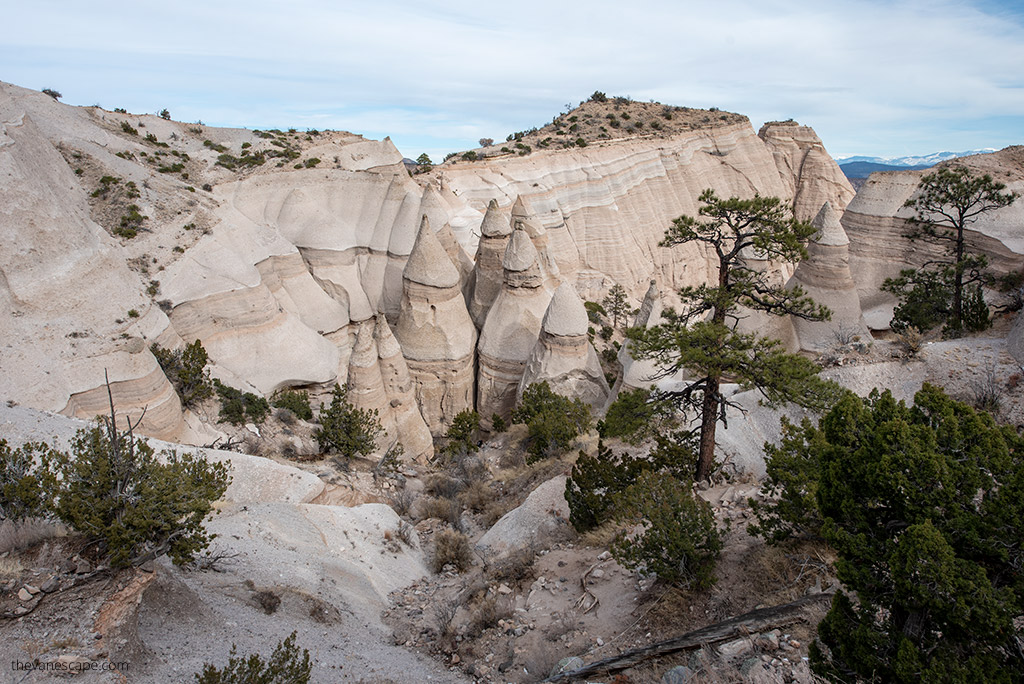
Kasha-Katuwe Tent Rocks Hike – Our Experiences
The Kasha-Katuwe Tent Rocks Hike is a great idea for a day trip from Albuquerque or Santa Fe. It is one of the best hikes in New Mexico. It’s only about a 3-mile one-way moderate loop trail through a slot canyon with hoodoos and striated rock formations that seem like cones or teepees.
Kasha-Katuwe means “white cliffs.” Furthermore, it is a religious site of the Cochiti Pueblo. So, in this article, we give you all the details to help prepare for this fantastic experience, which is the Kasha-Katuwe Tent Rocks Hike. We share our tips and experiences, as my partner Chris and I have visited this place personally. We made all the hiking trails in Kasha-Katuwe. Moreover, we took all the pictures presented in this article.
Important Note: Before going to Kasha-Katuwe Tent Rocks National Monument, check the official park website to see if it’s open. The latest update confirms that it will be open for the 2025 season, but some days it might be closed. The Monument is open Thursday through Monday.
Since access is now by reservation only, visitors must book their entry in advance through www.recreation.gov. A limited number of BLM ticket reservations are available daily, so it’s best to plan ahead and secure your spot early.
Alternatively, we recommend hiking in the Bandelier National Monument, hiking Bisti Badlands/De-Na-Zi Wilderness, or exploring Ah-Shi-Sle-Pah Wilderness Study Area (like Valley of Dreams or King of Wings hoodoo). Those are amazing places in New Mexico.
What is the Kasha-Katuwe Tent Rocks National Monument?
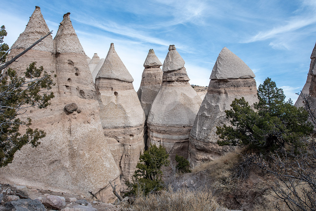
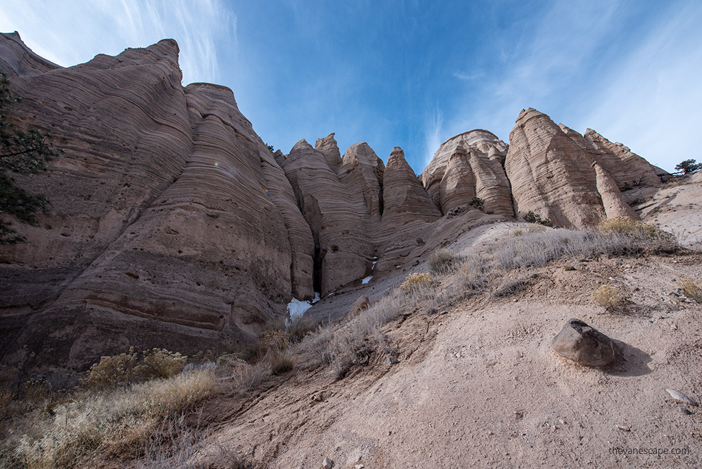
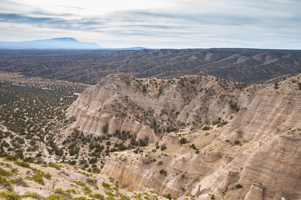
Kasha-Katuwe Tent Rocks National Monument is located on the Pajarito Plateau in north-central New Mexico, between 5570 and 6760 feet above sea level. The cone-shaped tent rock formations are the products of volcanic eruptions that occurred 6 to 7 million years ago and left pumice, ash, and tuff deposits over 1,000 feet thick.
Tremendous explosions from the Jemez volcanic field spewed rock fragments while searing hot gases blasted down slopes in an incandescent avalanche called a pyroclastic flow. Furthermore, the Tent Rocks vary in height from a few feet to 90 feet.
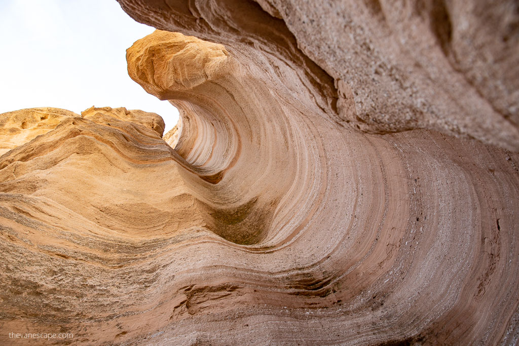
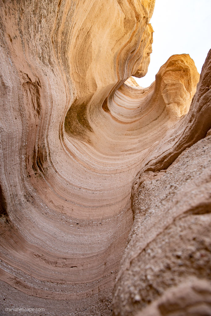
As a result of the uniform layering of volcanic material, bands of grey are interspersed with beige and pink-colored rock along the cliff face. Over the years, wind and water cut into these deposits, creating distinctive pointy hoodoos and the sinuous slot canyon. Finally, it was contouring inward ravines into smooth semicircles.
President Bill Clinton established the place as a U.S. National Monument in January 2001. It is managed by the Bureau of Land Management (BLM).
The Kasha-Katuwe provides hiking, birdwatching, geologic observation, and plant identification opportunities. Kasha-Katuwe Tent Rocks National Monument is a popular hiking destination from Albuquerque and Santa Fe. Hiking trails are for foot travel only.
If you do a Tent Rocks hike, you also go through a slot canyon and onto the mesa, leading to great views of the Sangre de Cristo and Jemez Mountains. So, if you are looking for the best hikes in New Mexico, take the Kasha-Katuwe Tent Rocks hike or Bandelier National Monument hikes.
Where is the Kasha-Katuwe Tent Rocks National Monument?
Kasha-Katuwe Tent Rocks National Monument is located around 40 miles southwest of Santa Fe, New Mexico, near Cochiti Pueblo. Albuquerque is about 54 miles north. So, it is perfect for a day trip from Santa Fe or Albuquerque.
Directions To Kasha-Katuwe Tent Rocks
Directions from Santa Fe
From Santa Fe, you should head south on I-25. Take the Cochiti Pueblo Exit 264 off I-25 onto NM 16. Then turn right off NM 16 onto NM 22, and follow the signs to Cochiti Pueblo and the National Monument. It’s about 50 minutes of driving. Check accommodation in Santa Fe on the map below to get the best deals.
Directions from Albuquerque
From Albuquerque, you must head north on I-25. Take the exit for Santo Domingo/Cochiti Lake Recreation Area (Exit 259) off I-25 onto NM 22. Then follow the signs on NM 22 to Cochiti Pueblo and Kasha-Katuwe Tent Rocks National Monument. It’s about one hour drive from Albuquerque. Check accommodation in Albuquerque below to get the best deals.
Kasha-Katuwe Tent Rocks National Monument – Hours of Operation
Before you go to the Kasha-Katuwe Tent Rocks Hike, you must know that it has short opening hours. So, plan your time properly. Kasha-Katuwe Tent Rocks National Monument is open from 8 am to 4 pm.
Closing procedures begin at 3:30 pm, so visitors must be out of the fee booth gated area by closing time. It is a day-use-only area. The park has no campground, and primitive camping is not allowed. The Monument is closed to dogs. Check the official website for any updates.
Furthermore, The place is closed several days a year to allow Pueblo de Cochiti cultural observances. Kasha-Katuwe Tent Rocks National Monument is closed on:
- New Year’s Day
- January 6
- Friday before Easter
- Easter Sunday
- Monday after Easter
- May 3
- July 13-14
- July 25
- November 1
- Thanksgiving Day
- Christmas Day
Are you interested in Pueblos & the Native American community in New Mexico? Check out our post about the famous Taos Pueblo.
Reservations & Access Requirements
Since entry is now by reservation only, visitors must secure their reservations in advance through Recreation.gov. A limited number of BLM ticket reservations are available daily, so early booking is highly recommended. The fee is $5 per person for visitors over 16, while those 16 and under can enter for free but still require a reservation. The America the Beautiful Pass covers the BLM ticket fee for the passholder and up to three additional guests.
Cochiti Pueblo Tribal Access Pass
In addition to the BLM reservation, visitors must obtain a Cochiti Pueblo Tribal Access Pass directly from the Pueblo before entering the Monument. Fees are $20 per person (16+), $10 per child (ages 2-16), and free for children under 2. A link to purchase this pass will be provided during the Recreation.gov booking process.
Please note that the Cochiti Pueblo Tribal Access Pass and the BLM Ticket Reservation are separate requirements, and both must be obtained for entry. The America the Beautiful Pass does not waive the Cochiti Pueblo Tribal Access Pass fee.
All visitors are required to check in at the Cochiti Visitor Center before entering the Monument. Check-in starts at 7:45 a.m., and guided entry with pilot vehicles begins at 8:00 a.m. The final pilot vehicle departs from the Visitor Center at 1:00 p.m., and all guests must leave the Monument by 4:00 p.m.
It can get crowded on the weekend, so getting a parking spot is worth being earlier. Be patient with the gate guards. They won’t let you in until a space is available for you to park. There are restrooms and picnic tables in the parking area.
Kasha-Katuwe Tent Rocks Hike
The Kasha-Katuwe National Monument includes two short trails.
- The Cave Loop Trail is 1.2 miles long, and it’s easy. The second and one of the best hikes in New Mexico is Slot Canyon Trail. It is called the Kasha-Katuwe Tent Rocks Hike.
- There is only one trailhead to Slot Canyon Trail and Cave Loop Trail. So, go straight to the Slot Canyon. And in the end, on your return, add Cave Loop Trail if you will have time. If you put them together in this way, it’s only 3.1 miles one way.
Slot Canyon Trail is around a 2.8-mile, one-way trek into a narrow canyon with a steep (630-feet) climb to the mesa top. Furthermore, it offers excellent views of the Sangre de Cristo, Jemez, Sandia mountains, and the Rio Grande Valley.
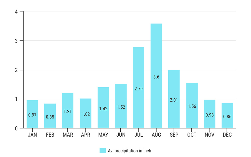
However, during heavy rain, flooding in the canyon is risky. So, check the weather before you go. Do not hike if there is any danger of flash floods in the slot canyon, especially in monsoon season (mid-June to mid-September).
How Long Does It Take To Hike Kasha-Katuwe Tent Rocks?
The primary hike, which goes to the top, can be done in 60 to 90 minutes, depending on your physical condition and how often you stop to take photos or enjoy the view.
Kasha-Katuwe Tent Rocks Hike Description
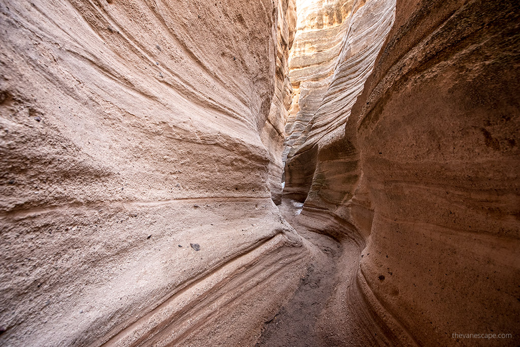
Slot Canyon
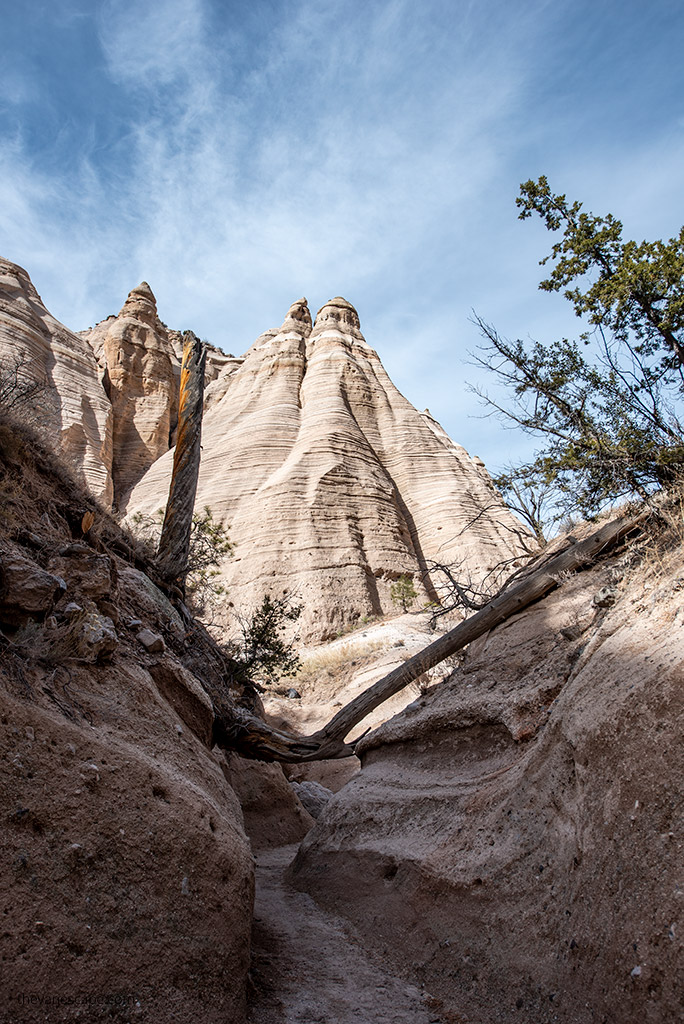
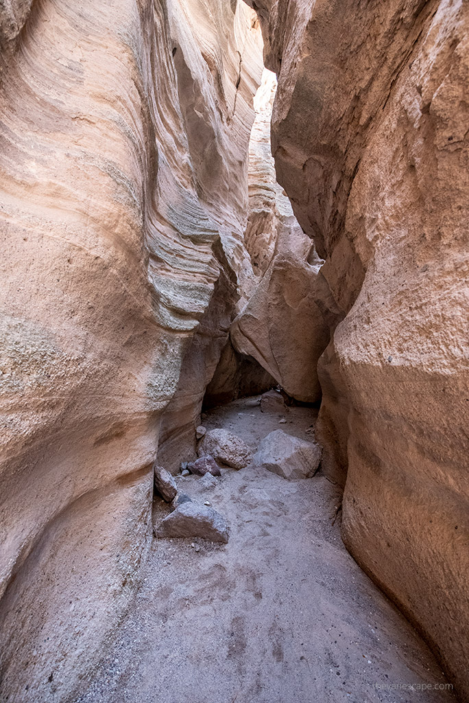
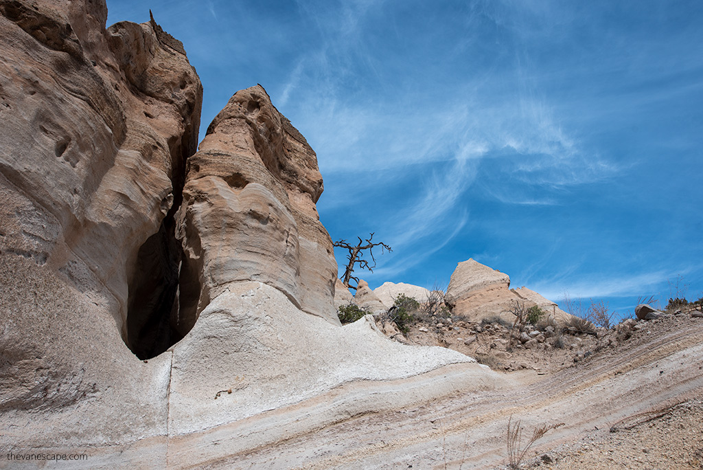
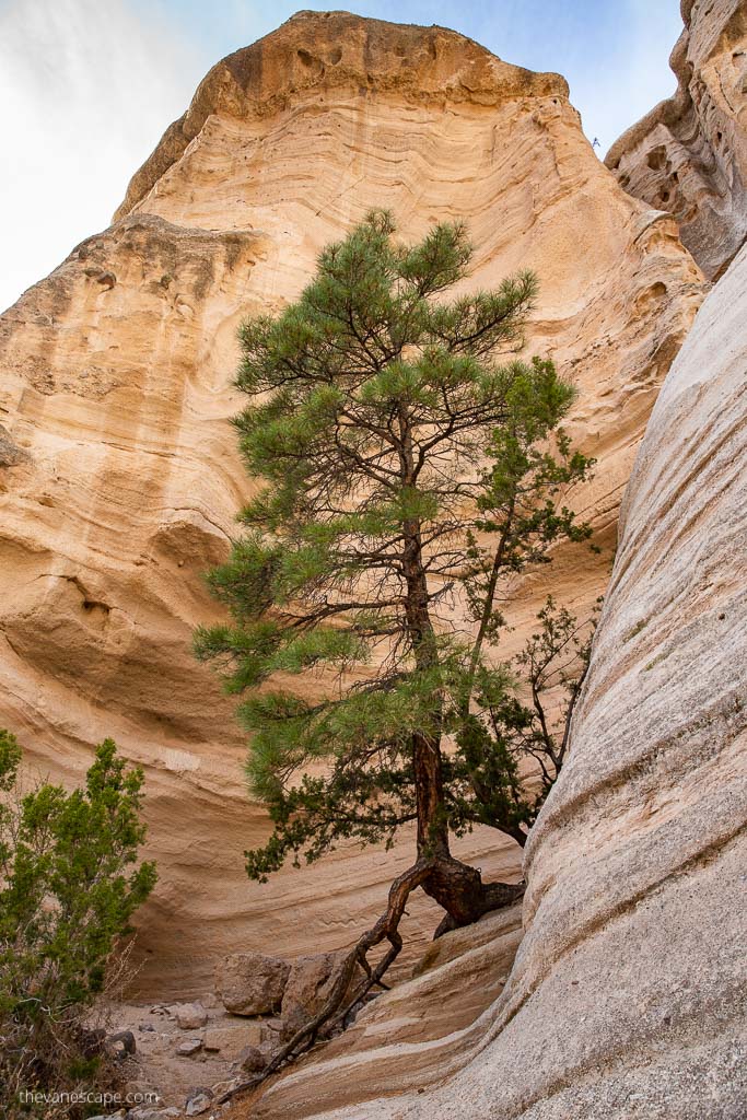
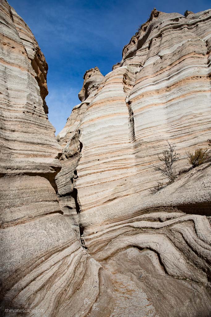
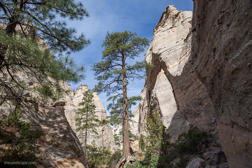
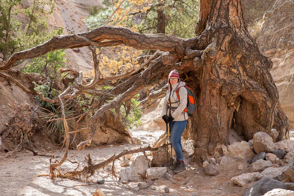
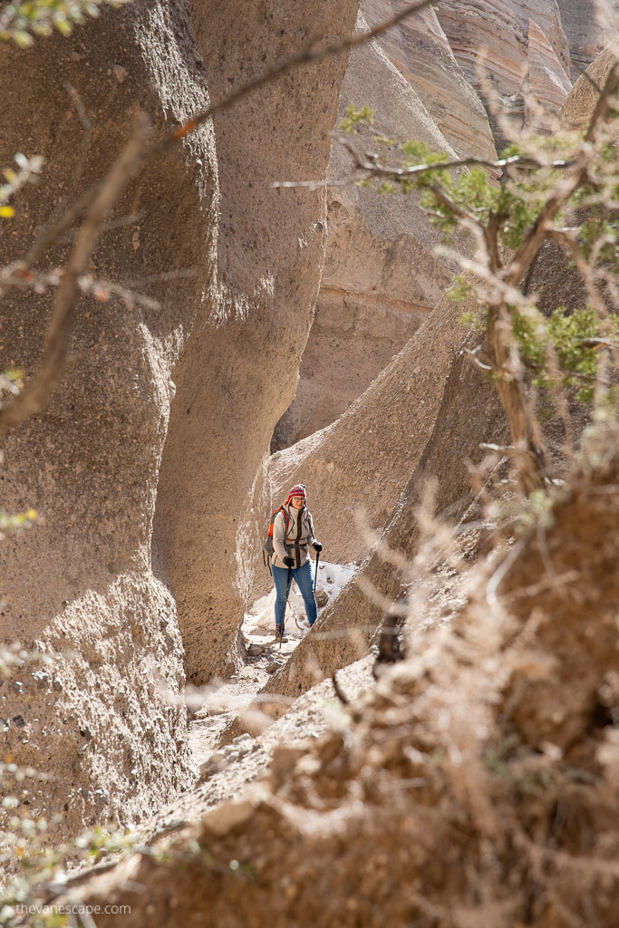
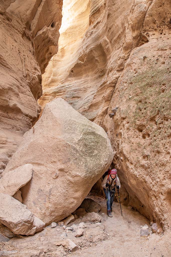
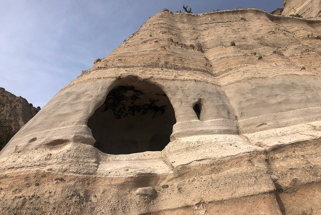
The first half of the trail is winds through a shady slot canyon. The slot has beautiful examples of rock strata, hoodoos, the effects of wind and water. It is so narrow you can touch the walls on either side. Moreover, you might have to walk sideways.
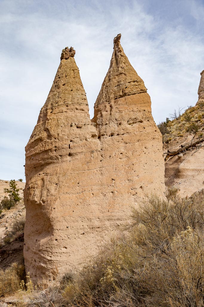
You can feel the cold and damp walls, their smooth surfaces. When you lift your head, you will see Tent Rocks looks like a rocket. The forces of water and wind continue to carve hoodoos from the cliffs. As the trail continues beyond the slot canyon, the hoodoos become larger and more varied in shape.
There are a few obstructions along the way, so you’ll have some scrambles over some rocks blocking the path. The trail is the bottom of the wash, and looks like a tunnel. So be careful in case of heavy rain.
Climbing To The Mesa Top
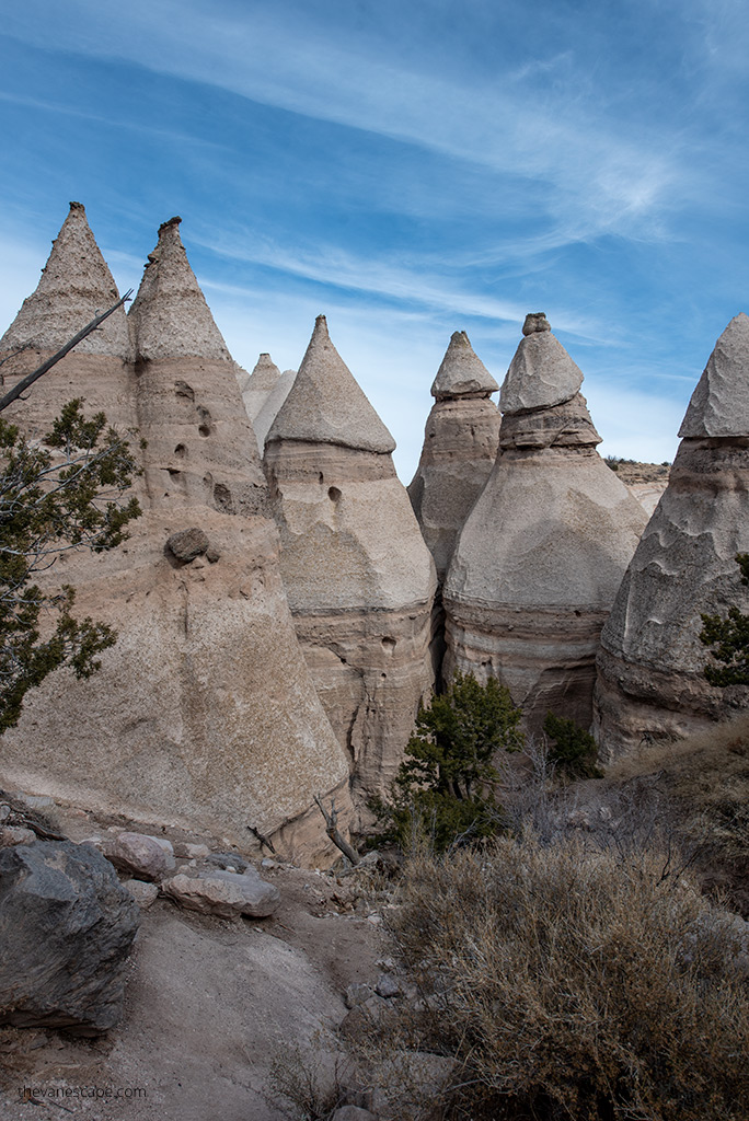
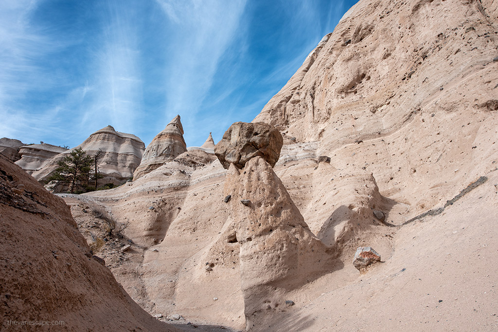
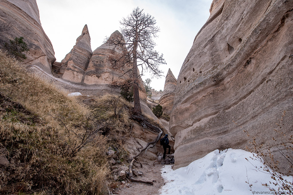
The trail switchesbacks 640 feet to the plateau. After 1.1 miles, it turns to the left to pass beneath some of the best formations. The canyon opens beneath the 90-foot conical hoodoos that give this National Monument its name.
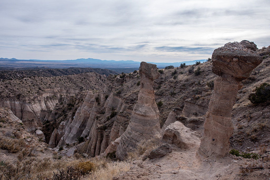
It begins to climb steeply on a crumbly, eroding trail, with occasional scrambling required. There is a viewpoint just before mile 2. The trail continues to climb higher, out of the canyon. There is the second viewpoint at mile 2.1. It is a great view of the canyon and the surrounding formations.
There’s also a little balancing rock close by this vista. The path continues up and then down on the canyon rim. It’s about 0.3 miles to the final viewpoint. It’s worth it to go to the top. White cliffs are spectacular from the plateau.
From the top of the mesa, you overlook the slot canyon and Tent Rocks, as well as sweeping views of the Rio Grande River Valley to the east and the Jemez Mountains to the west.
Return via The Cave Loop Trail
Return the way you came, but continue at the Cave Loop Trail junction. It intersects with the Slot Canyon Trail. On your return walk, the Cave Loop Trail is easy and short. It is relatively flat and has lovely views.
It is well-marked, with numerous warnings about snakes, the importance of staying on the trail, and the ban on rock collecting.
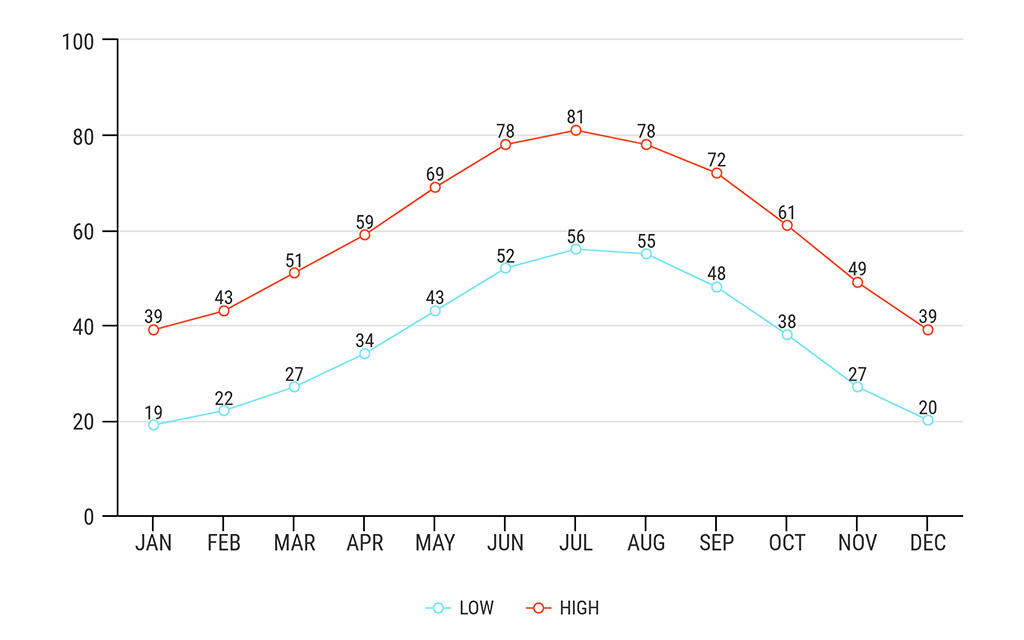
Kasha-Katuwe Tent Rocks Hike – Check the Weather
When is the best time to visit the Kasha-Katuwe Tent Rocks National Monument? We did the Tent Rocks hike in December 2019. It was cold but sunny and perfect weather for a walk. If you are going in the summer, take a plentiful water supply. There is shade in the slot canyon, so take a warm jacket.
The monsoon season runs from mid-June to mid-September. So, always check the weather or the forecast before you go—it is a slot canyon, so it is susceptible to flash flooding. Below, we have prepared charts with average temperatures and precipitation in the Kasha-Katuwe Tent Rocks National Monument.
What To Bring For Kasha-Katuwe Tent Rocks Hike?
Whether the trail is short or long, easy or demanding, you must always be prepared for your hike. Accidents happen, or the weather can change dramatically in a few minutes. That’s why we pack carefully, even for shorts and leisurely walks. Check out what to pack for a day hike in our separate article.
First, wear proper hiking shoes. Do not attempt this hike in flip-flops or even flimsy shoes. You need sturdy shoes with a good grip and tread.
It is a rattlesnake land, so be cautious. Protect your legs with pants. Make lots of noise with your feet, and don’t reach down near any stumps or logs. Hiking poles will be useful during this hike also.
Pack yourself in a comfortable backpack. You should have a hiking backpack with a lap belt so that it relieves your spine while climbing.
Watch your body while hiking. Even experienced hikers have weaker days. If you start to feel dizzy, disoriented, or nauseated, take a rest. Drink water, eat a salty and high-protein snack, and rest as long as you feel better.