Driving the Top of the World Highway
Planning to cross the U.S.-Canada border via the Top of the World Highway? This remote, scenic highway connects Alaska and Yukon. The Poker Creek-Little Gold Creek border crossing, located on the Top of the World Highway, is the northernmost international border crossing in North America. Read our tips on how to prepare for this road trip adventure!
This article may contain affiliate / compensated links. For full information, please see our disclaimer here.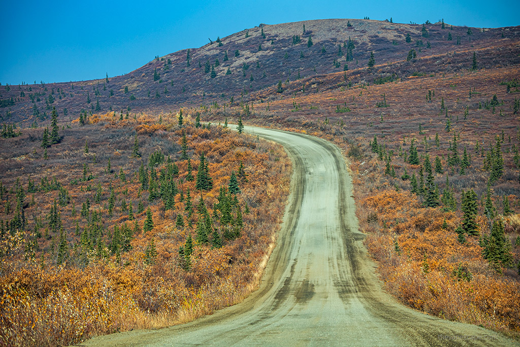
Where is the Top of the World Highway?
The Top of the World Highway is a 79-mile (127 km) highway that crosses two countries, the United States and Canada. It connects Alaska with Yukon. The Top of the World Highway begins at a junction with the Taylor Highway (Alaska Route 5) at Jack Wade. It then runs east to its terminus at the ferry terminal in West Dawson, Yukon, on the west bank of the Yukon River. This way, you can reach the picturesque Gold Rush-era town of Dawson City.
So actually the Top of the World Highway consists of two parts. The part in Alaska is known as the Taylor Highway or Alaska Route 5. The entire portion of the highway in Yukon, Canada, is also known as Yukon Highway 9. But both are known as the Top of the World Highway. So, from Dowson City, Yukon to Tok, Alaska total distance is 187 miles (300 km) via the Top of the World Highway and Taylor Highway.
The most important thing is that it is only open during the summer months. The Top of the World Highway is open from May to September, but the US-Canada border is open only during the three summer months! We made it while traveling around Alaska in our camper track.
Driving Distances via Top of the World Highway
- The distance from Tok, Alaska to Dawson City, Yukon is 187 miles / 300 km.
- From Tetlin Junction, Alaska to Dawson City, Yukon is 175 miles /281 km via the Top of the World Highway.
- If you drive from Fairbanks, Alaska to Dawson City, Yukon is 398 miles/640 km.
- From Chicken, Alaska to Dawson City, Yukon is 106 miles/171 km.
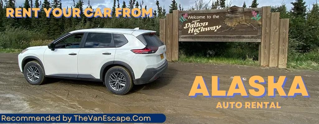
- If you plan to rent a car, consider Alaska Auto Rental. Check our detailed review of this company.
Top of the World Highway Map
The MILEPOST is the best source for travel by car or RV through Alaska and Canada. Buy it if you plan an adventure road trip from the Lower 48 or Canada to Alaska. Also, purchase it if you plan a fantastic road trip from Alaska to Canada or the Lower 48. The MILEPOST maps and information are priceless.
The MILEPOST contains mile-by-mile descriptions of more than 15,000 miles of road in Alaska, Yukon, the Northwest Territories, British Columbia, and Alberta. We have used Milepost on each travel through Alaska, driving the Dalton Highway, and northwest Canada. It was also a valuable resource on the Alaska Highway and the Dempster Highway, where we had no internet access, no phone reception, and no electricity for days.

- The best travel guide and map to Alaska
- The best travel guide and map to Yukon, Northwest Territories, British Columbia and Alberta, Canada
- The MILEPOST includes mile-by-mile descriptions of more than 15,000 miles of road in Alaska, Yukon, Northwest Territories, British Columbia and Alberta
- Its 600-plus pages detail accommodations, camping, fishing, gas stops, restaurants, attractions and services along the highways and byways of Alaska and western Canada
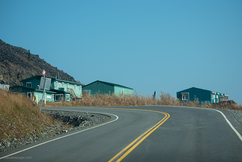
The Poker Creek – Little Gold Creek Border Crossing
Yes, you can cross the U.S.-Canada border via Top of the World Highway. The Poker Creek-Little Gold Creek border crossing, located on the Top of the World Highway, is the northernmost international border crossing in North America.
It connects the communities of Chicken, Alaska, and Dawson City, Yukon. Note, however, that this border crossing between Canada and the United States is only open during the summer months. For the rest of the year, these border crossings are closed.
So if you are planning a long road trip from the Lower 48 to Alaska via Canada, you can only choose this border crossing during the summer months. Also, if you want to drive from Alaska to Canada, check to see if the border crossing is open.
We crossed it in the first part of September as we headed for the Demster Highway. But for season 2022 it will be closed earlier.
Opening Hours of Border Ports of Entry
According to Alaska’s News Source, the crossing port will be open for three months this summer. Only from June 1 to September 1, 2022.
The border will allow motorists across from 8 am to 6 pm (Alaska time). It’s a change from previous years’ schedules. When we crossed this border, it was open till 8 pm, and it was mid-September. Border protection requires an I-94 form to make the crossing. Don’t also forget your proper ID / valid passport and visas (if needed). Also, remember that there is a one-hour difference in standard time zones at this border. US Phone is (703) 921-7750/7751.
PRO TIP: Not all rental vehicles are allowed on this road. So check with your rental company before you travel. Also, not all rental companies agree to cross the border between Canada and the US. So check carefully the terms of the contract and if you can make such a trip with a rental car. We did this road trip in our RV.
What you Cannot Bring Across the Border
If you plan to cross the U.S.-Canada borders, remember to check your car and luggage carefully to make sure you are not carrying prohibited items. Some of the things you are not allowed to bring across the border. You are not allowed to bring firearms. But you also cannot bring fresh produce, fruits, and vegetables. You cannot cross the border from the US into Canada with fresh produce. They will be confiscated. Have a picnic and eat your fresh produce before you drive to the border crossing.

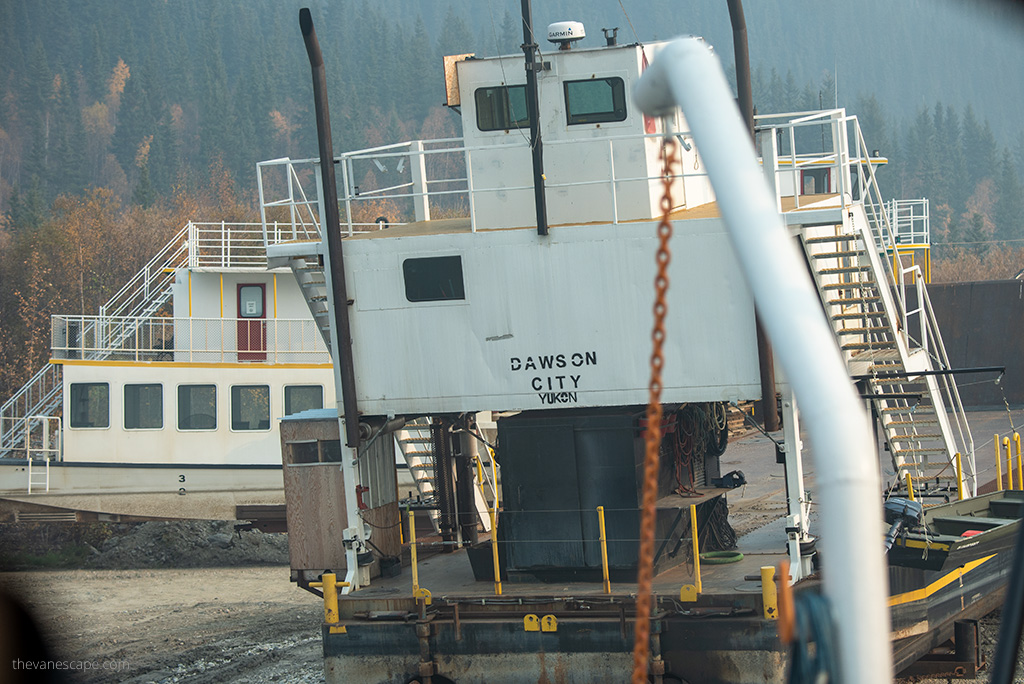
George Black Ferry
If you are entering or leaving Dawson City on the Top of the World Highway, you must take the George Black Ferry. It crosses the Yukon River. It is a free service that runs 24 hours a day, except on Friday morning, when it closes for maintenance between
5 and 7 am. It operates only during the summer months. In winter, the river is frozen, and the residents cross it on foot or by snowmobile.
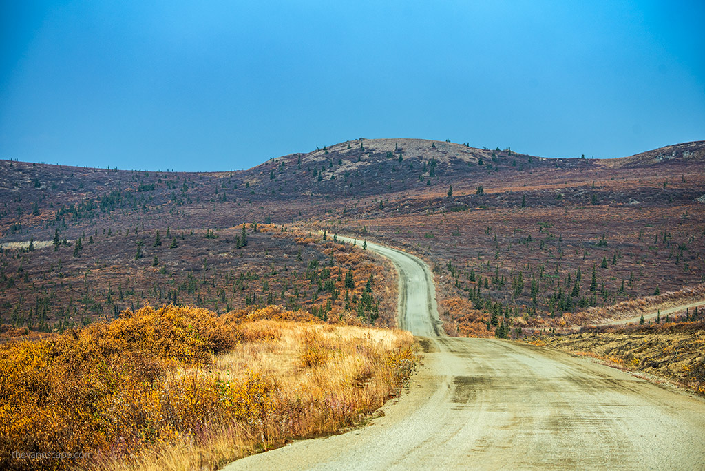
Is the Top of the World Highway paved and challenging?
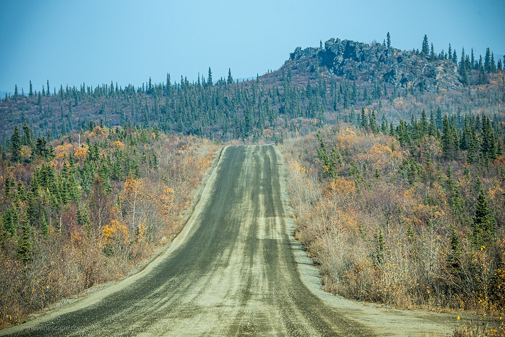
Most of the U.S. portion of the highway is paved from the Taylor Highway junction almost as far as Chicken. Most of the Canadian portion is unpaved. There are short paved sections only.
The Top of the World Highway is not difficult to drive. However, as always, you must be careful. Especially when the weather changes, the drive can be challenging. It is wide and has few steep drops. It is much easier on the Alaska section, which is paved. Traffic is very light there, but be careful, drive slowly and follow the rules. The remote Top of the World Highway is a very scenic drive, so admire the views.
Plan your trip so that you only drive during the day. There is nowhere to stay overnight on the Top of the World Highway. Also, remember that the border crossing is closed at night. You can stay here overnight as long as you are completely off the roadway and the site is not marked as private property. But to be honest, we did not see many places on the highway that could be safe and nice for a night. Plus, there are no facilities and no phone reception the entire way.
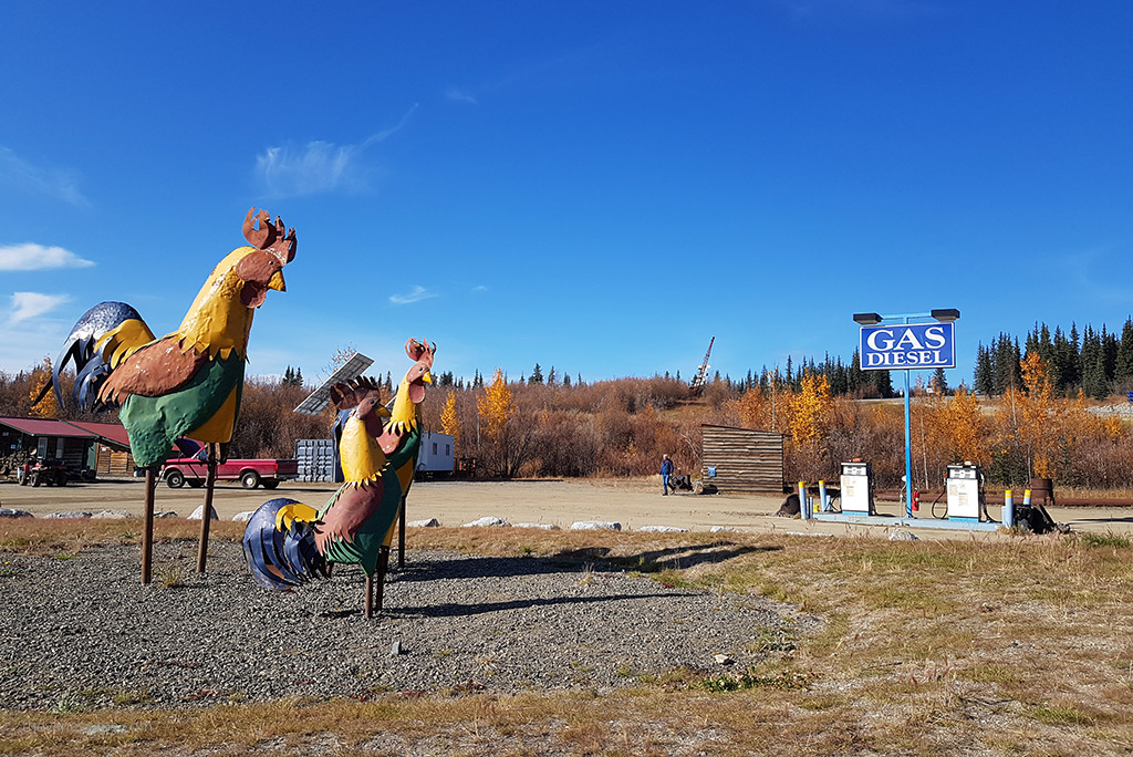
Be sure to fuel up in Dowson City, Chicken, or Tok. There are three gas stations on the 187 miles / 300 km route.
How Long Does it Take to Drive the Top of the World Highway?
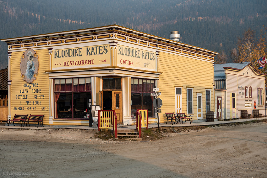
It all depends on what car you are driving, the weather conditions, the traffic at the border crossing, and the inspection. And, of course, on how often you’ll stop on the road. From the more exciting places, it is worth stopping in the quirky town of Chicken in Alaska. It also depends on the queue for the ferry. So take the time for this road trip. It took us all day with stops for lunch and stops for pictures.
Driving the Top of the World Highway Tips
The Top of the World Highway is a remote road. Technically is not a tricky road, but drive carefully and follow the regulations. It can be challenging in case of rain or fog. There is not much traffic on it. But there are no facilities and services on this route. So before you go on this journey:
- Check that the car you plan to drive is in working order, that the brakes are working, that you have changed the oil and brake fluid, etc.
- If you are planning to travel by rental car, be sure to check the conditions at the rental company and whether it is allowed to drive this route and cross-national borders.
- Be sure to take a spare tire with you. The road is gravel. It has some holes in it. You may need to change your tires.
- Pack a spare tire with a tire repair kit and a can of fix-a-flat. Check our Road Trip Packing List Essentials.
- Be sure to fill up your gas tank before the trip. The only gas station on the route between Dawson City and Tok is Chicken.
- Plan a day trip. Remember the time difference between Yukon and Alaska.
- Pack your ID/ valid passport and other documents if you plan to cross the border.
- Be sure to pack your map.
- Remember that there is no phone reception on this route. You will not have internet access.
- Pack a supply of water and snacks. Remember that you will not be able to transport fresh produce across the border.
Short History of the Top of the World Highway
The highway is called the Top of the World Highway because it skirts the crests of mountains for much of its length, providing views of valleys. It is also one of the northernmost highways in the world at these latitudes. Two highways running farther north are the Dempster Highway (Yukon Route 5) and the Dalton Highway (Alaska Route 11).
The Top of the World Highway was completed around 1955. However, the U.S. maintained border controls at Tok, Alaska, 120 miles (190 km) away until 1971. In 2001, the U.S. and Canada established a joint border inspection station at the Poker Creek-Little Gold Creek Border Crossing, where inspectors from both countries work in a single facility. The border crossing is at an elevation of over 4,515 feet (1,376 meters)
The Top of the World Highway looks like a beautiful route. I think we may have taken it during a childhood trip to Alaska, while heading towards Denali National Park! I’d love to do a self-drive in this region one day. Good to know about the lack of overnight stops on the route.
This was a wonderful read about the top of the world highway. What surprised me is that you cannot bring fresh produce from the US to Canada. I am wondering why so? However the route seems really interesting and I would love to do this once in my lifetime. I will be definitely checking Milepost for amazing ideas.
Being from the uk, I’ve never heard of the no top of the world highway.. it looks amazing and like so many other highway in the states something I would love to do on a Harley. But based on the weather conditions you speak of prob not the best idea…Dawson city is somewhere I’ve heard of and love to visit as well… lovely blog
Writing this 6/25/2022, I have 6 friends traveling this road. They are on Motorcycles. They are women on their way to a convention in Rapid City. I believe they are on 1 Harley, 2 Harley trikes, a Spyder a Goldwing and a sport bike! The pictures they have posted are absolutely amazing!!!!
Thank you for the tips, especially the things that you cannot bring across the border. I think it would be a great experience to drive here and simply enjoy the scenic view.
The Top of the World Highway looks like such a beautiful and remote place to drive. I would love to do it, even if the Canadian section of the road is not paved. It’s good to know that this road is only opened in summer and that the border control closes at night. It’s good to know these details when you are planning the road trip there.
This is such a magnificent route to take, so nestled in wildlife. I would enjoy doing this someday, as long as I had a travel partner to take turns with the driving. The idea of these little quirky stops along the way makes it all the more interesting. I can see why you would want to fill up your gas tank and have an emergency kit for the route. I bet it would be some time before AAA got there to help, LOL!
When I saw the blog title, I wondered why it was called the “Top of the World Highway”, and now I know, thanks to your inclusion of its brief history. This road appears to be a fantastic route for road adventures. I’ve also taken note of its operating hours for future reference.
We drove the top of the world highway pre covid . It was the most amazing journey
I have done this highway! We drove from Chicken, Alaska to Dawson City in the Yukon. It was fall and the mountaintops were all golden, reddish alpine tundra!
One day we will plan a trip this far north and would love to drive the Top of the World Highway from Alaska to Yukon. We will definitely check out the Milepost Maps. And be careful about the list of things we can’t take across the border. A good tip to plan your stops well. Saved for one day!
The highway looks like it goes to nowhere. What an amazing adventure!
It makes sense why you need to check with the car rental whether you allowed to drive here or not. It’s really remote and there’s no cell service! Imagine if something happen. Your tips are really helpful for those who want to take this highway.
Sounds like it would be quite an adventure to drive the Top of the World Highway! Not sure I’d be comfortable with a long stretch of partially paved roads and no services, but I imagine the scenery must be amazing. Did you see a lot of wildlife too?
Firstly, I wasn’t aware that there is a Top of the World – I got it confused with the Roof of the World. Anyway, I wouldn’t have expected it in northern America. It’s interesting that you’re not allowed to bring produce across the border since it’s basically one continent. However, I totally understand that Canada does not want to have the amount of weapons they have in the US….
My wife and I did this drive at the last minute. Do not regret the adventure. As the article mentions, get the “Milepost”, and have new tires and spare. Can’t wait to do it again. Stop in Chicken for lunch!
I am a US citizen. I was in the process of crossing the border driving along highway 9, Top of the World, after leaving Dawson City. It was at about 7:00 PM Sunday, July 16. I was at about 50 km from the ferry crossing and a lady in safety vest holding an official traffic STOP sign halted me and waved me over, as if she was stopping traffic for construction work ahead, just as was occurring regularly throughout Yukon. There was no traffic, no heavy road equipment, no construction going on. She ordered me to proceed down a side road as a detour to avoid heavy equipment ahead, as she said. I could see vehicles down that detour side/dirt road. It all seemed out of place. I refused to comply and hastily drove on with her shouting at me to stop. Needless to say she was not with the Yukon highway department, nor was there any heavy equipment or official detour. It was Sunday night! I believe she was up to nefarious activities and had accomplices on that side road, possibly a robbery. I did not report the incident to the US border patrol, since it was not on US soil.
I contacted the Yukon Highway Department the following day of the incident electronically, once able to establish communication, and they have referred me to (RCMP) just today.
Top of the World Highway has no law enforcement since police have no need to cross the ferry at Dawson unless absolutely necessary. So beware of traveling this highway to the US border.